Cayuga Lake


The Ithaca Canal Boat

It was on November 17th of 2024 when we picked up a number of targets while mapping Cayuga Lake. It wasn’t until April 24th of 2025 when we return to put an ROV down on some of the targets. This one turned out to be an old Canal Boat approximately 80 feet in length by 14 feet in width.  We now call it the Ithaca Canal Boat due to the fact that it is on the South end of the lake near Ithaca.

3D image of wreck


The Ithaca Cruiser

It was on November 17th of 2024 when we picked up a number of targets while mapping Cayuga Lake. It wasn’t until April 24th of 2025 when we return to put an ROV down on some of the targets. This one turned out to be an old Chris-Craft Cruiser approximately 28 feet in length by 10 feet in width that we now call the Ithaca Cruiser due to the fact that it is on the South end of the lake near Ithaca.

3D image of wreck


The Cayuga Lake Aurora Canal Boat. On Nov. 25, 2023 we were on Cayuga Lake to do a sonar survey. Before we started our survey we did this 3-D photogrammetry work on a well known canal boat. It was originally discovered by Craig Bates of Atlantic City, New Jersey, and Michael DeGroat of Union Springs in 2013. The canal boat is about 90 feet in length and about 70 feet below the surface. Her final resting place is about a half mile offshore and about 2 miles north west of Aurora. We completed the 3-D photogrammetry work on this site then went on to survey more of the lake. We found a canal boat in deep waters as well as some other targets. We will return to the lake to investigate these other targets on another day.

3D image of wreck

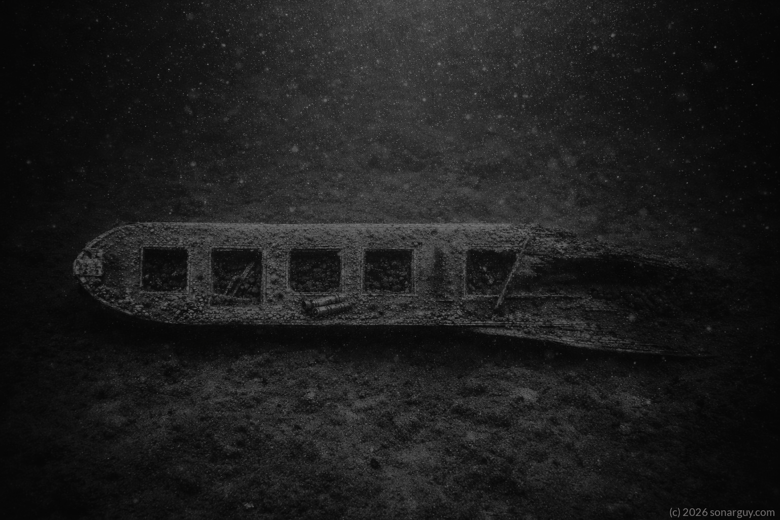
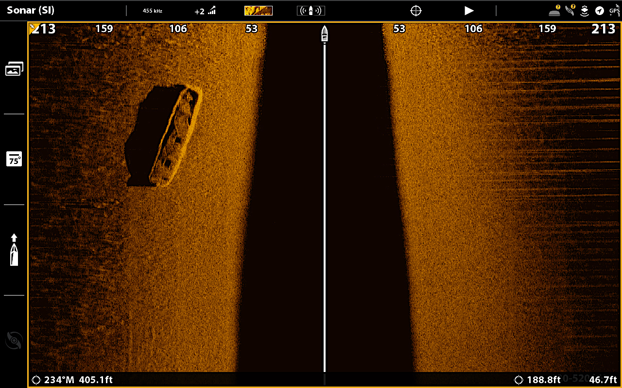
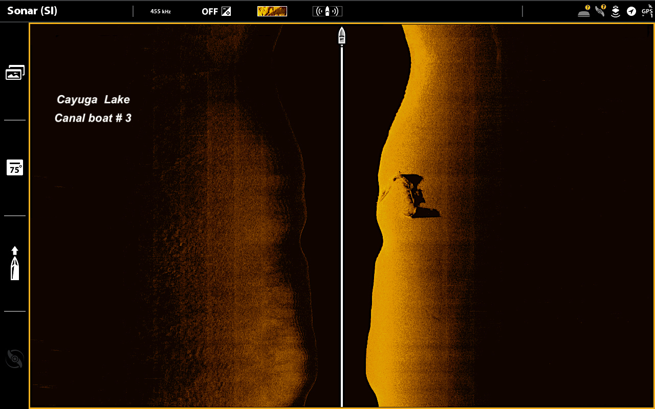
Sonar scan of the Aurora canal boat target # 1.
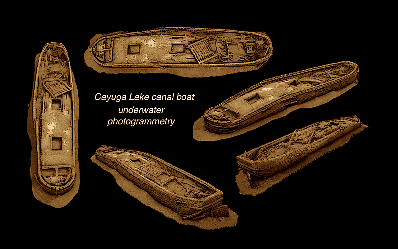
3-D photogrammitry

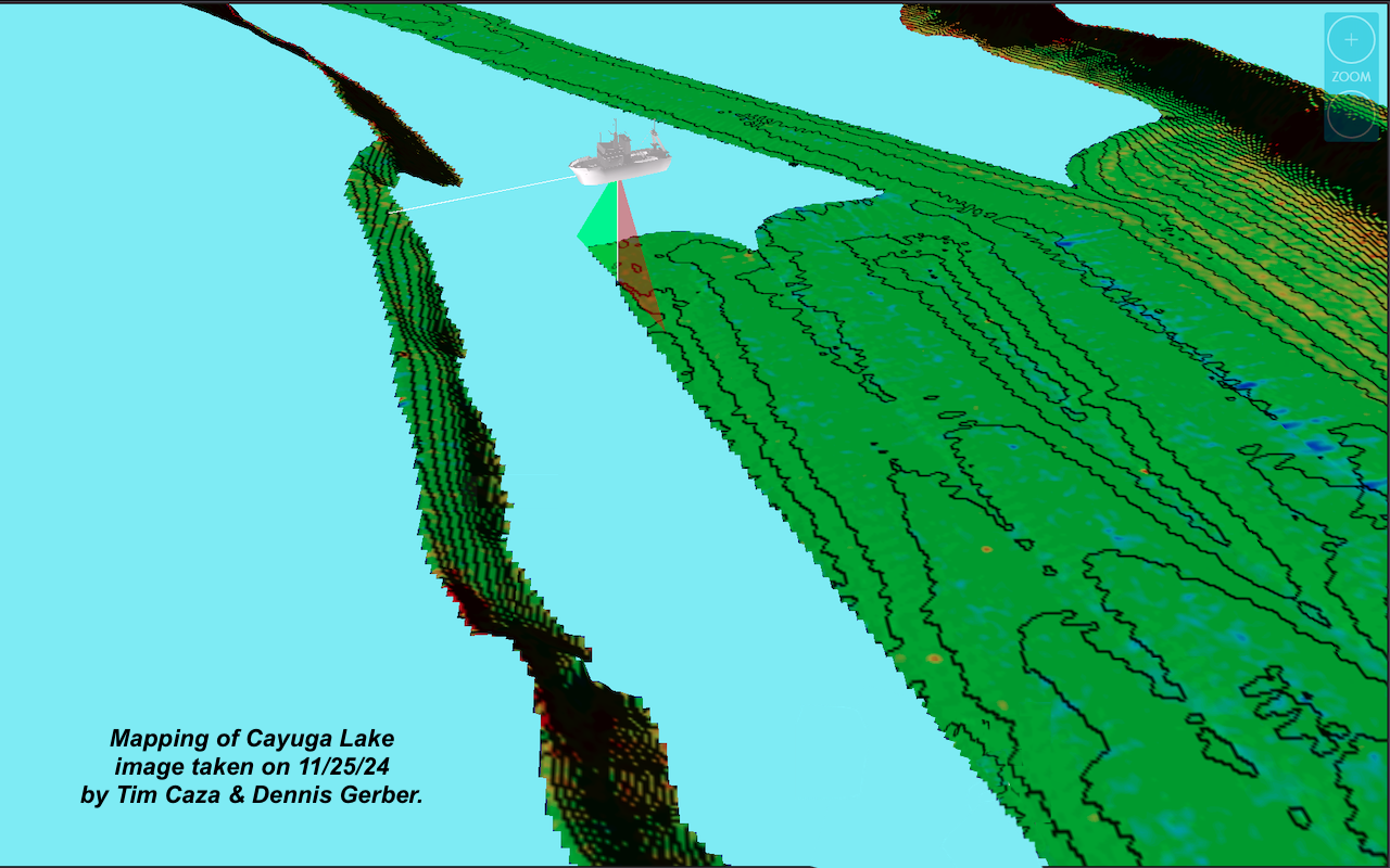
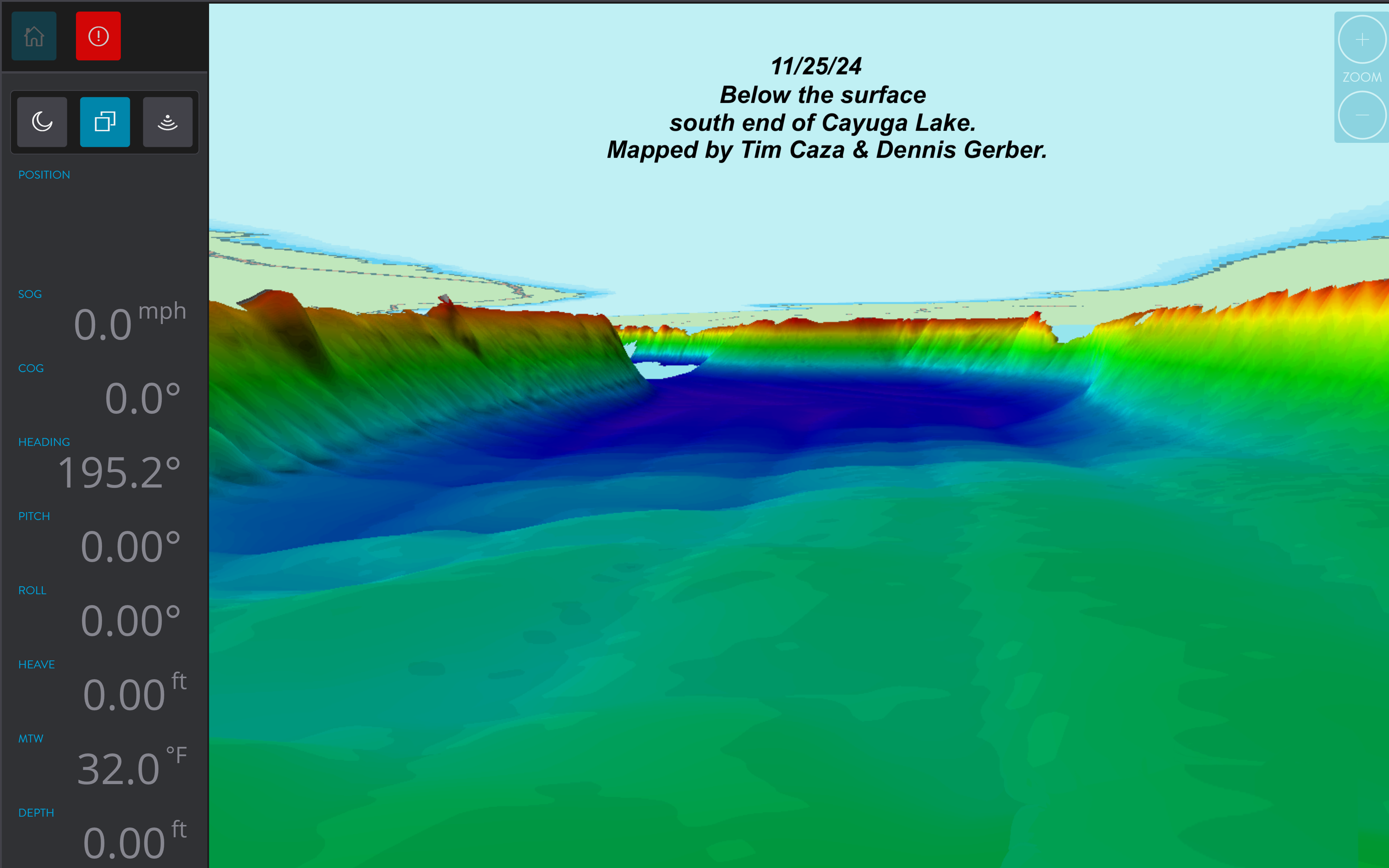
3D mapping of Cayuga Lake.

3-D Multi beam image of the bottom of Cayuga lake.

Target # 2 a canal boat.

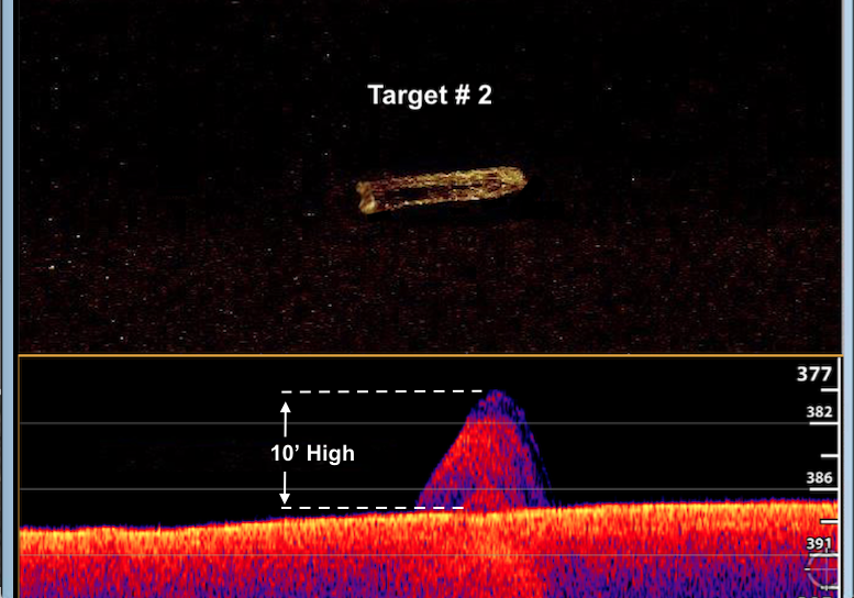
Multi beam sonar of target # 2

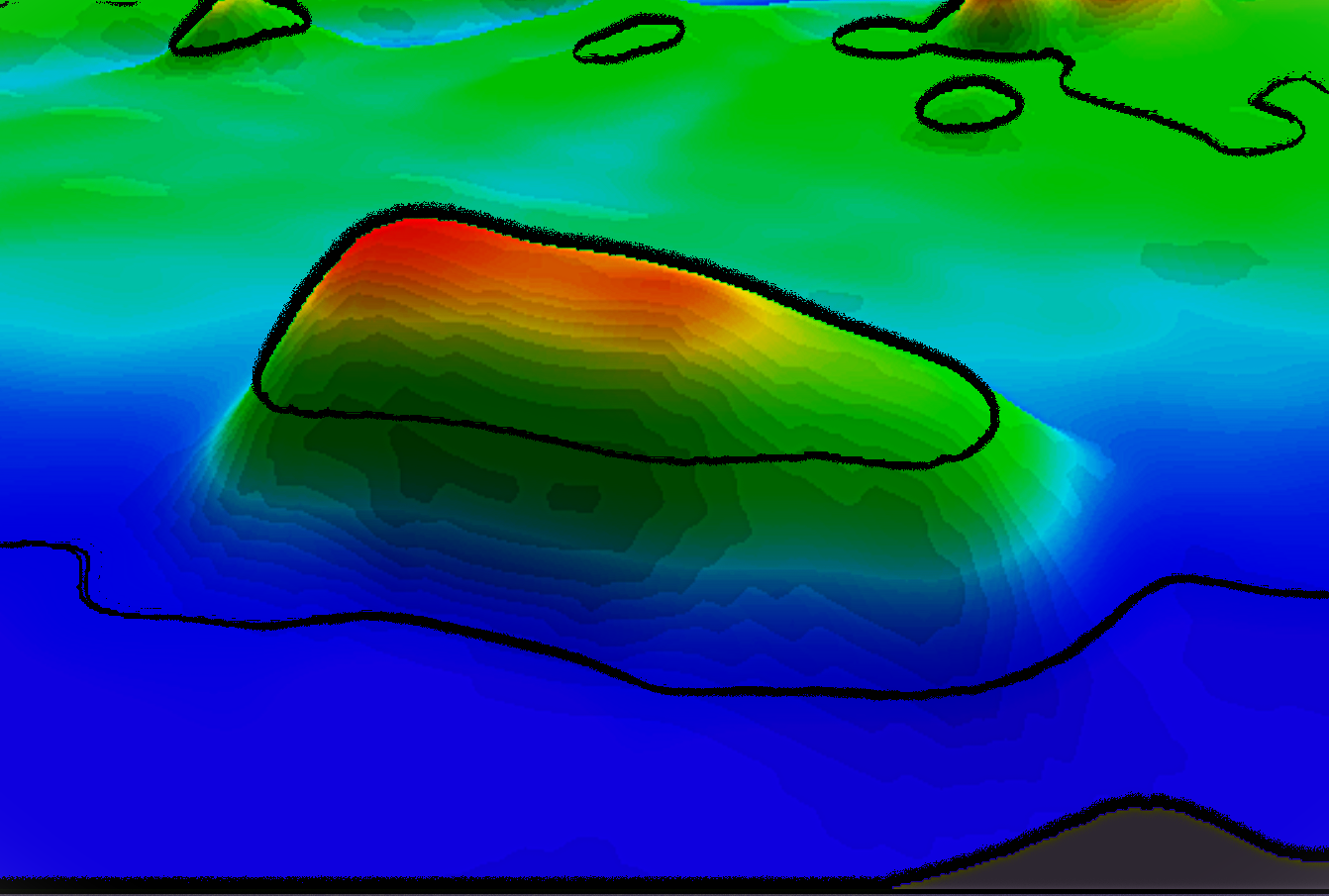
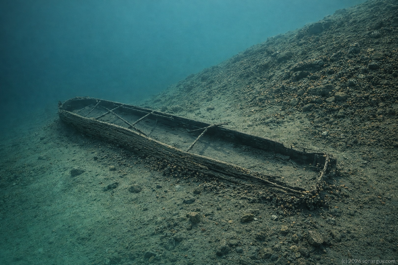
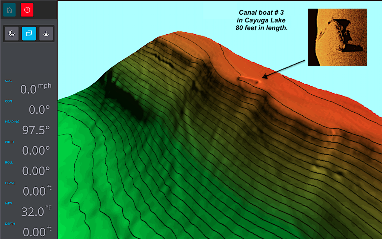
Target # 3 a canal boat.

3-D multi beam target # 3

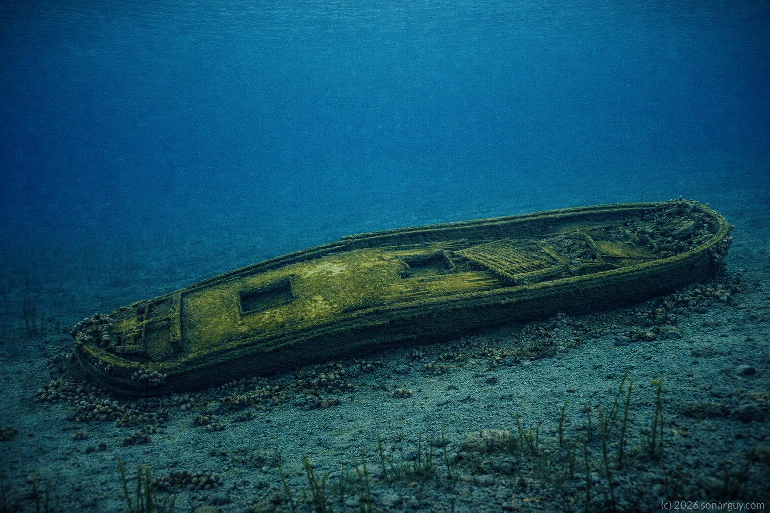
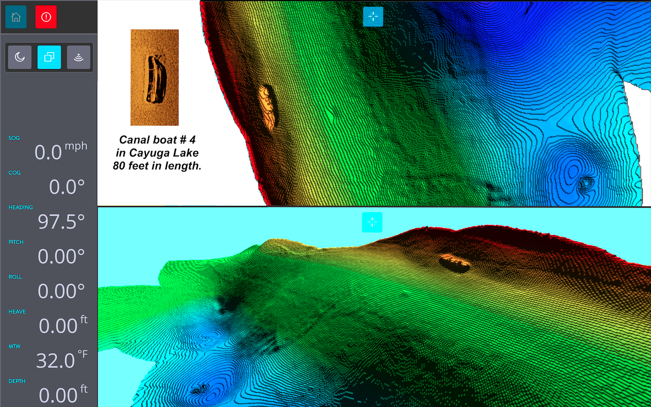
Target # 4 a canal boat.

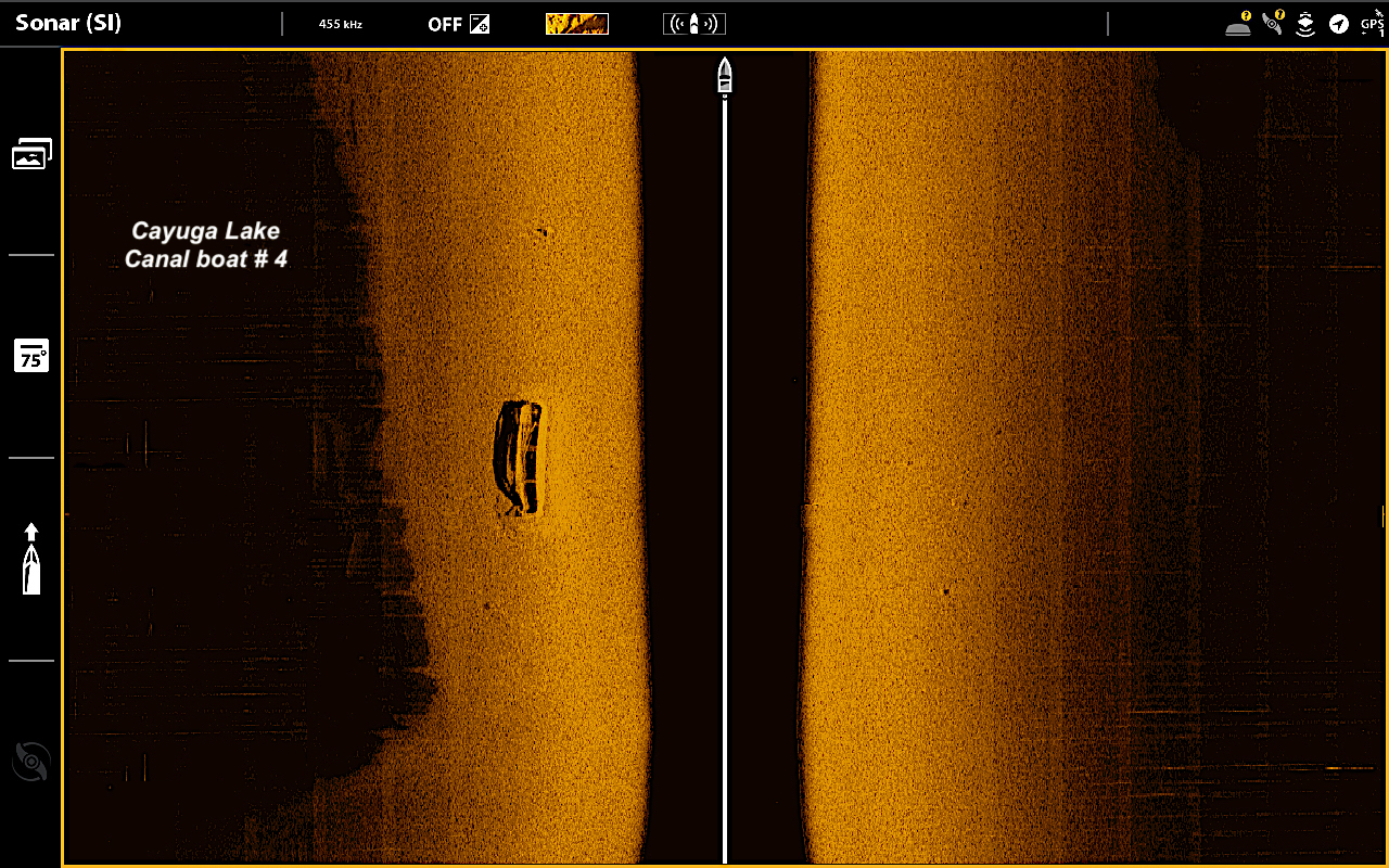
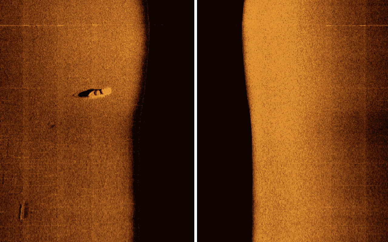
Multi beam sonar target # 4

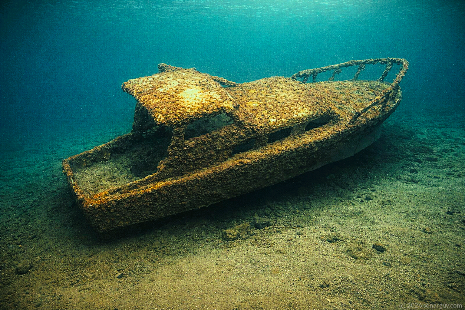
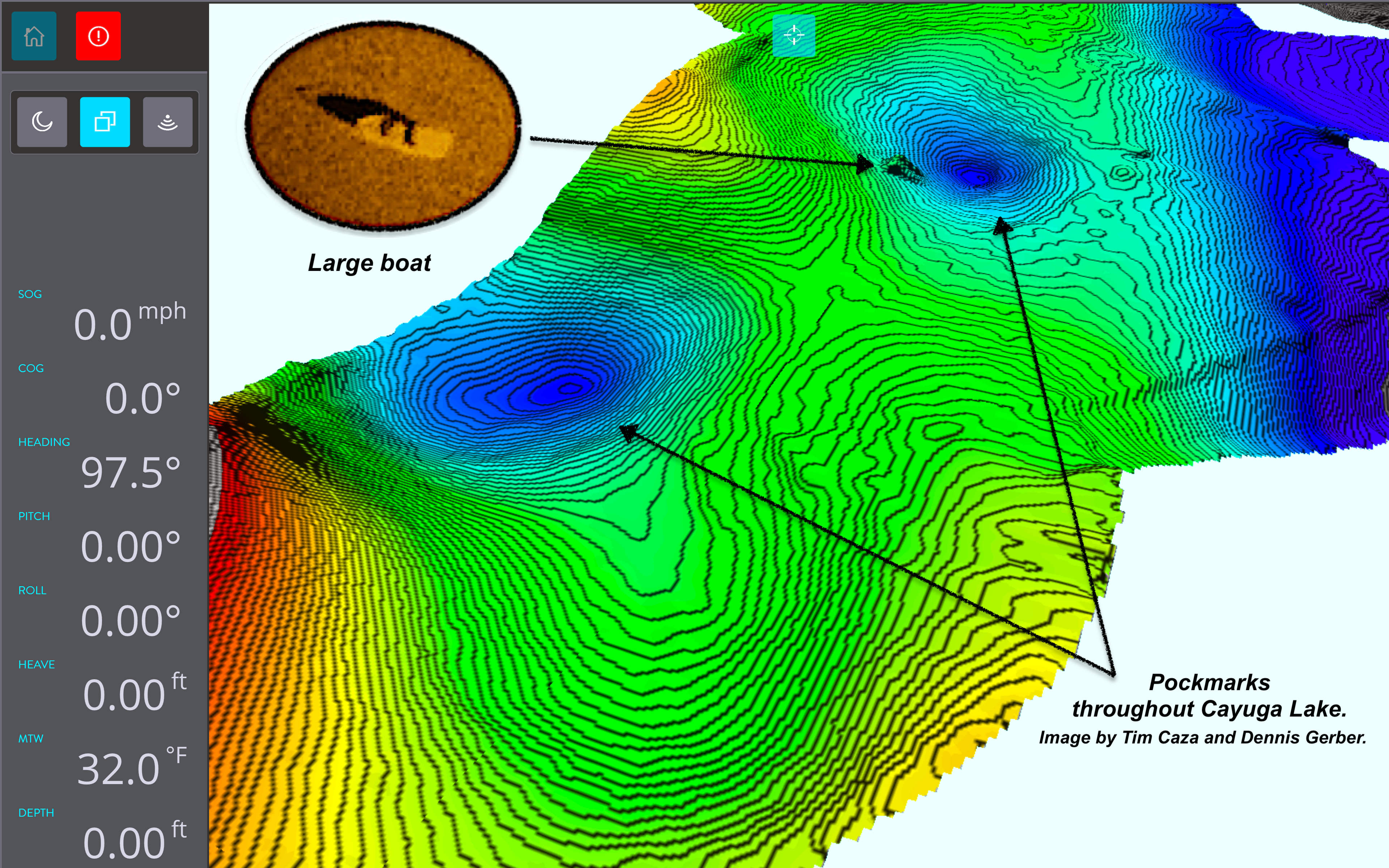
Target # 5 large boat.

Multi beam sonar pockmarks and large boat.

Target # 6


Results from the season of 2024 in Cayuga Lake.

In the season of 2024 we began the sonar surveys and multi beam surveys of Cayuga Lake.  We did locate various targets during the season.  Most of them canal boats and a possible plane that we labeled target # 6 in extremely deep waters of the lake.  We hope to return sometime in 2025 to do some photogrammetry work of these sites.  

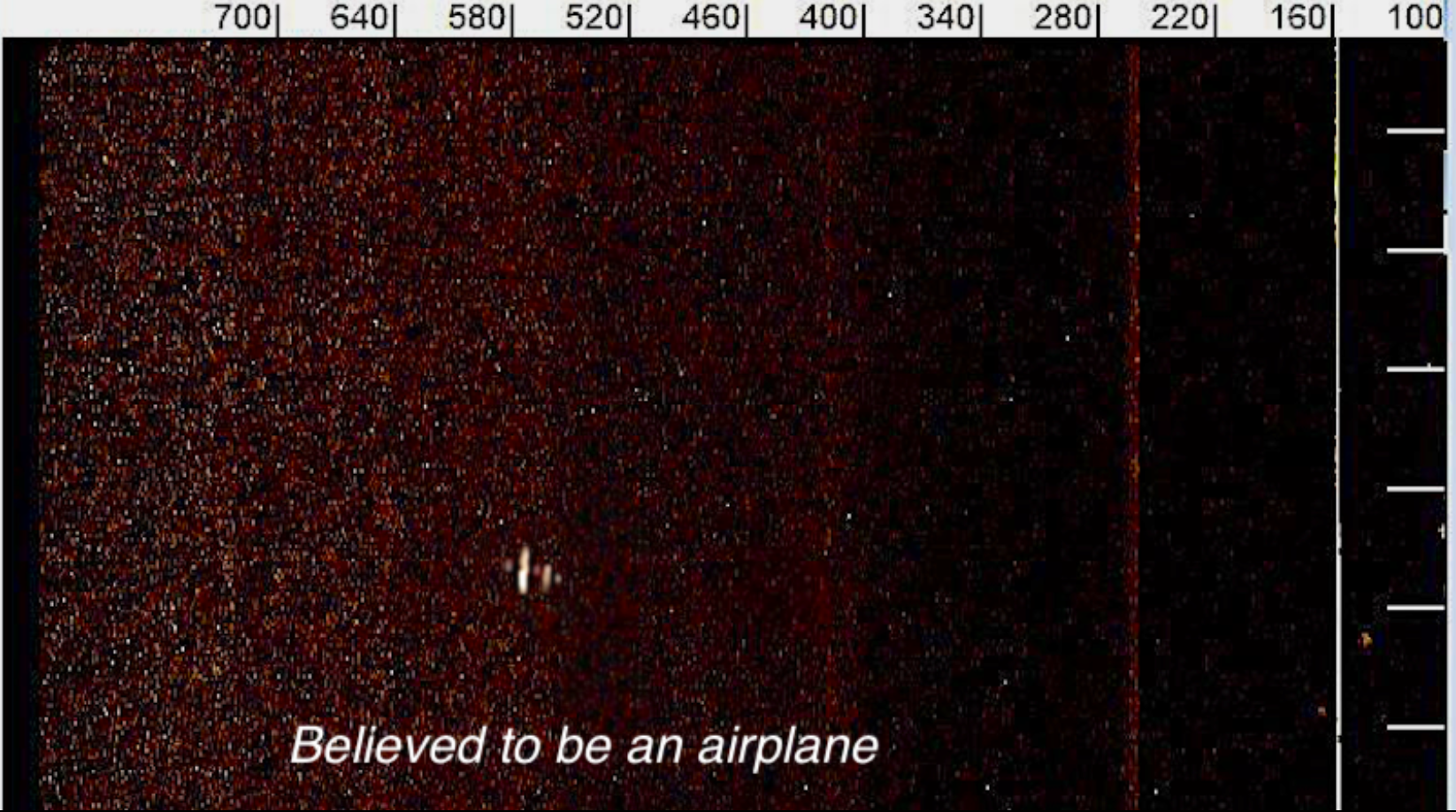
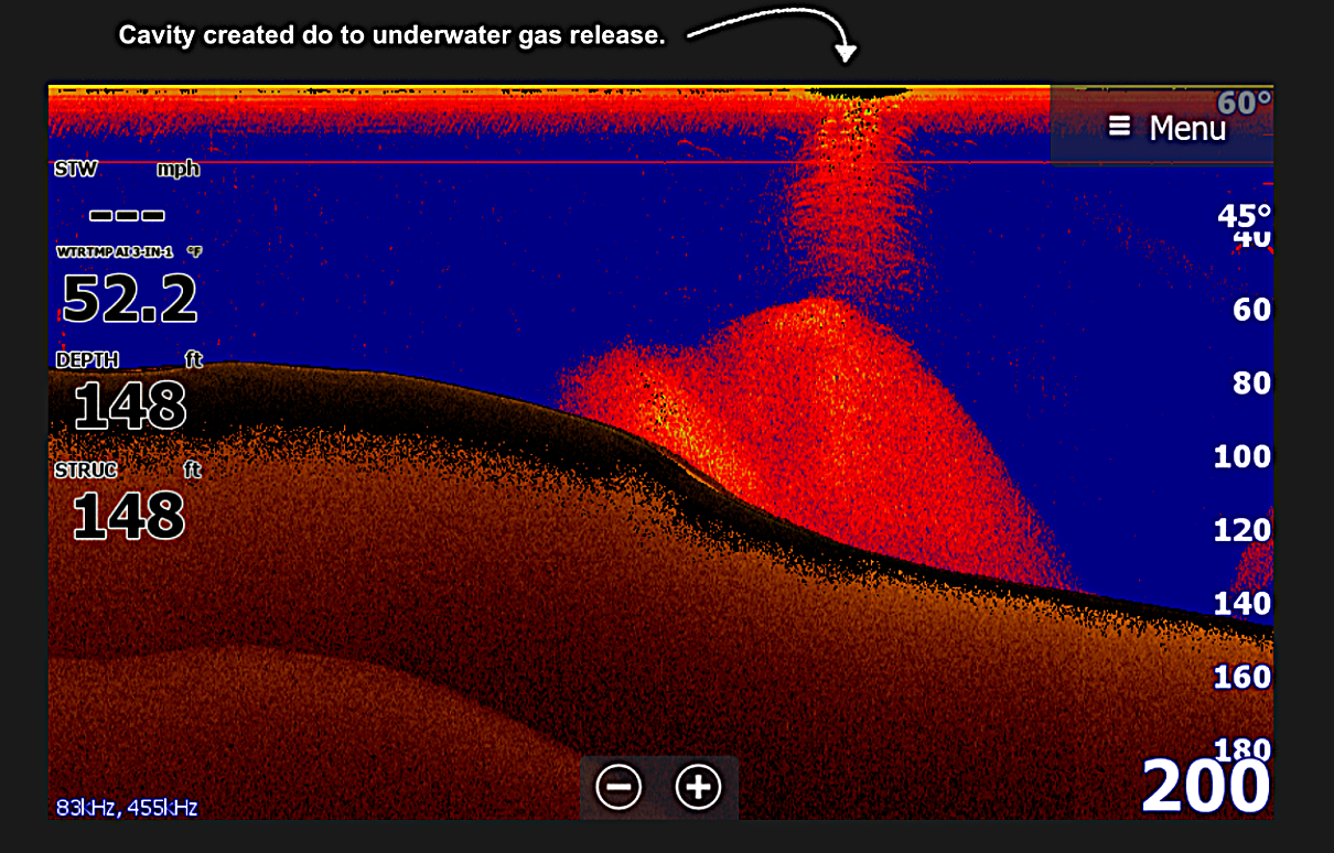
Gas bubbles from the bottom of the lake.


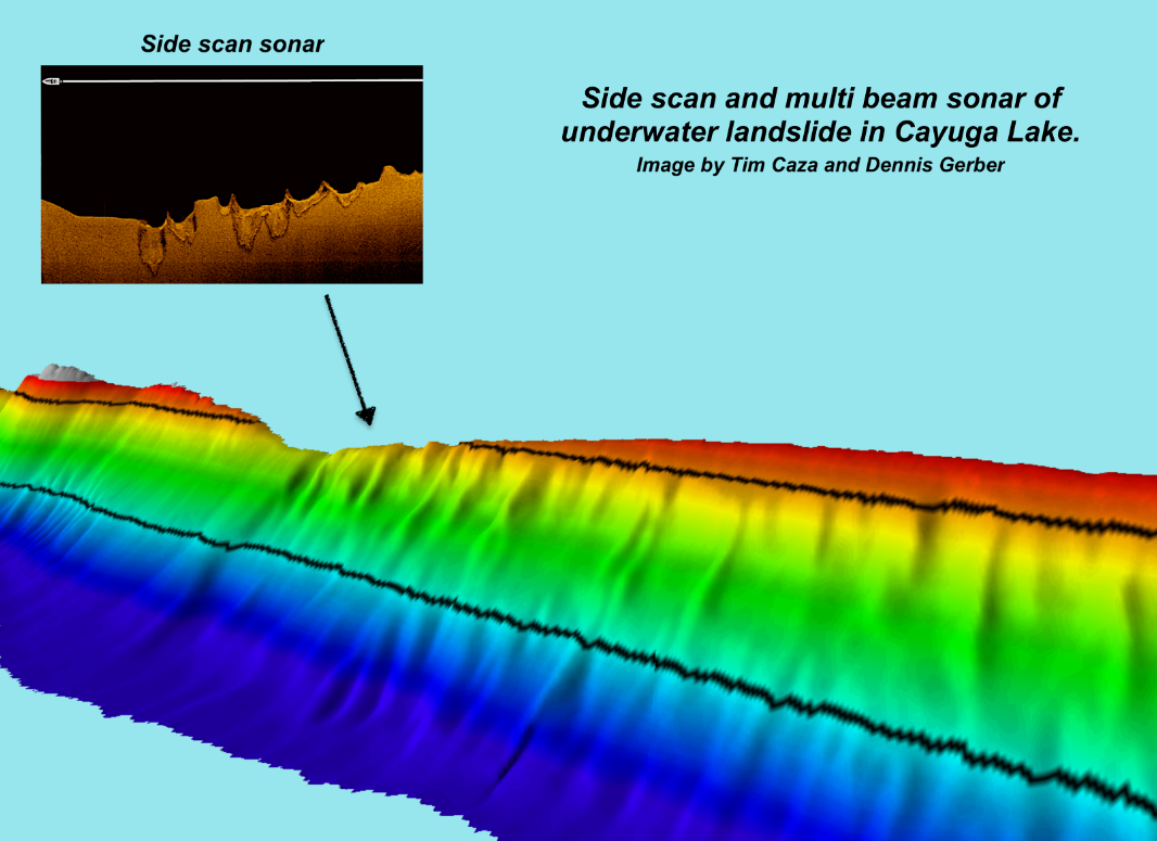
Underwater landslide in Cayuga Lake.

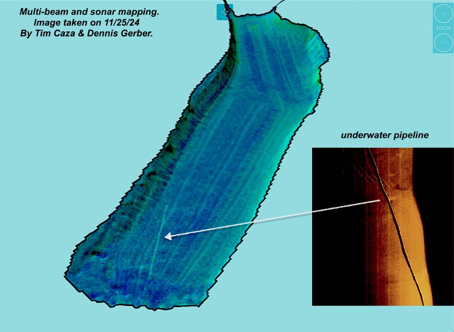
Underwater pipeline in Cayuga Lake.

You need to add a widget, row, or prebuilt layout before you’ll see anything here. 🙂